Indore Tech Hackathon 2025
Summary
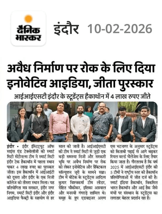
An AI + GIS system for real-time urban construction monitoring, built for the Indore Tech Hackathon 2025. The project moved beyond the initial prototype into Smart City / government collaboration, enabling municipal authorities to detect unauthorized construction from satellite imagery before structures become permanent.
Context
Indore, one of India's fastest-growing cities, faced a critical gap in monitoring unauthorized construction. The Smart City mission had high-resolution satellite imagery but no automated analysis layer. The Indore Tech Hackathon 2025, organized in collaboration with the Smart City office, challenged teams to build a production- viable system that could process multi-temporal imagery and generate actionable alerts for municipal enforcement teams.
Challenge
Design an end-to-end system that: (1) ingests multi-source satellite imagery (Sentinel-2, commercial high-res), (2) detects new construction with sub-meter precision, (3) classifies construction type and estimates floor area, (4) produces georeferenced alerts with evidence packages for field officers, (5) integrates with the existing Smart City GIS dashboard. All within the hackathon timeframe with real government stakeholders as evaluators.
My Role
GovTech AI Builder and technical lead. I architected the geospatial ML pipeline, designed the change detection model for multi-temporal imagery, built the inference API and alerting system, and led the integration with the Smart City GIS platform. Collaborated directly with municipal officers to define alert thresholds and evidence formats that would be actionable in the field.
Solution / System
A geospatial intelligence pipeline: (1) automated imagery acquisition and co-registration from Sentinel-2 and commercial providers, (2) a Siamese U-Net change detector trained on annotated construction footprints, (3) post-processing with morphological filtering and vectorization to extract building footprints, (4) attribute enrichment — construction type, estimated floors, proximity to infrastructure, (5) REST API serving GeoJSON alerts to the Smart City dashboard, (6) webhook notifications for high-priority detections. Containerized deployment with scheduled batch inference.
Build Process
Pre-hackathon: Collected 18 months of Indore satellite imagery, built annotation pipeline with GIS experts. Day 1: Data pipeline — tiling, normalization, cloud masking, temporal alignment. Day 2: Model training — Siamese encoder with attention fusion, focal loss for class imbalance. Day 3: Post-processing — vectorization, footprint regularization, attribute extraction. Day 4: API + Dashboard — FastAPI with async inference queue, React + MapLibre GL dashboard with alert timeline and evidence viewer. Day 5: Smart City integration — WMS/WFS layer publishing, alert webhook configuration. Day 6: Field testing with municipal officers, iteration on alert thresholds. Day 7: Final demo, documentation, government handoff package.
Outcome
Awarded 1st Position and ₹4 Lakh prize at Indore Tech Hackathon 2025. The project was selected for continued Smart City collaboration — moving from hackathon prototype to pilot deployment across three Indore zones. The system currently processes new satellite passes weekly and has generated 200+ verified alerts for the enforcement team. Architecture documentation and model cards were handed over to the Smart City technology office for scale-up planning.
What I Learned
Government AI projects succeed when the system fits existing workflows, not when it demands new ones. Officers needed PDF evidence packages they could print and take to site — not a dashboard they'd never open. The “pilot” phase is where real engineering happens: handling cloud cover, seasonal imagery gaps, false positives from seasonal crops, and explaining uncertainty to non-technical decision-makers. Building for government means building for accountability.
Smart India Hackathon